Augsburg
Showing 25–36 of 48 results
-
Out of stock
A lovely little map of Europe engraved by Elias Baeck from the rare “Der curiose und .. Nussliche Dollmetscher..” published in Augsburg in 1748 by Erdmann Machenbauer. The map has a decorative cartouche and nice original colouring.
- Year: 1748
- Dimension: 220 x 160 mm
- Place of publication: Augsburg
-
A beautiful well engraved view of Florence by Johan Georg Merz after Werner from the very rare serie La famosa e meritevole città di Firenze, cioè i più considerabili prospetti delle Chiese, Residenze, Pallazzi, Piazze e Ville published in Augsburg, 1735. Cfr. British Museum 1897,0113.56
- Dimension: 31 x 20,5 cm
- Place of publication: Augsburg
- Year: 1735
-
Very rare map engraved by Elias Baeck from ?Der curiose und .. Nssliche Dollmetscher..? published in Augsburg in 1748. The map has decorative cartouche and a nice original colouring. Missing in many reference.
- Year: 1748
- Dimension: 220 x 155 mm
- Place of publication: Augsburg
-
Plan and fortification of the town from “Force D’Europe…” by G. Bodenehr published in Augsburg in 1725. Perfect condition. [cod.286/15]
- Year: 1725
- Dimension: 155 x 240 mm
- Place of publication: Augsburg
-
Copper engraving from “Curioses Staats-Kriegstheatrum in Bayern, Franken, Hispanien, Italien” published in Amburg in 1702 by J. Stridbeck and his son J. Stridbeck Junior. [cod.099/15]
- Year: 1725
- Dimension: 165 x 290 mm
- Place of publication: Augsburg
-
Out of stock
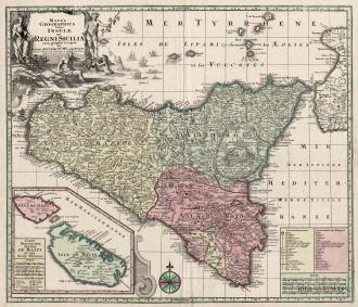
A stunning map of Sicily published by M. Seutter in 1730. Inset at bottom a nice map of Malta and Gozo. Showing also the Etna erupting.
- Year: 1730
- Dimension: 580 x 500 mm
- Place of publication: Augsburg
-
Superb 18th century map of the whole of Italy that also includes the islands of Corsica and Sardina, part of Sicily and the coastline of Balkans. Beautifully engraved with Seutter’s typical bold style and detail. Title cartouche at top right features several cherubs and in the opposite corner features a distance scale with a river god, a globe and several putti. As usual, both cartouches are uncolored. Published in Augburg in 1725 ca. by M. Seutter.
- Year: 1725 ca.
- Dimension: 573 x 490 mm
- Place of publication: Augsburg
-
Superb 18th century map of the whole of Italy that also includes the islands of Corsica and Sardina, Sicily and the coastline of Balkans. Beautifully engraved with Seutter’s typical bold style and detail. Title cartouche at bottom left features several allegorical figures. Published in Augburg in 1734 by M. Seutter.
- Year: 1734
- Dimension: 490 x 573 mm
- Place of publication: Augsburg
-
Out of stock
Graziosa riduzione della carta dell’Italia del Seutter che nonostante le dimensioni riesce ad essere molto dettagliata e precisa. Arricchita da grande cartiglio allegorico con il titolo e un secondo, in alto a destra, con tre scale grafiche per le distanze. Tratta dall’opera Atlas Minor Praecipua Orbis Terrarum di Tobias Lotter edito ad Augsburg nel 1744.
- Year: 1744
- Dimension: 200 x 255 mm
- Place of publication: Augsburg
-
Town plan of Paris at the left and right side with a text about the city. Published in Bodenehr’s Curioses Staats und Kriegs Theatrum. Gabriel Bodenehr (1664 – 1758) was a copper engraver and publisher. In 1716 he bought the copper plates of Johann Stridbeck (1640 – 1716), revised and completed them with his own maps, views and plans, and published them in several works with different titles.
- Year: 1725
- Dimension: 270 x 150 mm
- Place of publication: Augsburg
-
A rare and beautifully engraved and richly detailed panoramic view of Parma. With in lower part description of the city in German and Italian. Published by Engelbrecht in Augsburg in 1730. [cod.073/15]
- Year: 1730
- Dimension: 300 x 205 mm.
- Place of publication: Augsburg


