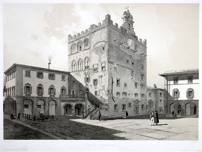
A beautiful tinted lithograph showing the Palazzo Comunale in Prato by O. Saunier based on a drawn by A. Durand from the famous “La Toscane” published in Paris at Lemercier in 1863.
Palais Communal a Prato
A beautiful tinted lithograph showing the Palazzo Comunale in Prato by O. Saunier based on a drawn by A. Durand from the famous “La Toscane” published in Paris at Lemercier in 1863.
- Author: DURAND Andr
- Year: 1863
- Dimension: 455 x 320 mm
- Place of publication: Paris
€ 300,00
Related products
-
A rare and early separately issued plan of Pisa published by Matteo Florimi in 1603 circa . The plan covers the city in its entirety and showing on the left the Campo dei Miracoli with its famous Baptistry and leaning tower. Title in a strapwork surround surmounted by the arms of the Medici and Pisa, key in strapwork cartouche at upper left corner. Soli was a Sienese architectural draughtsman, painter, and engraver, who worked with…
- Author: FLORIMI Matteo
- Year: 1603
- Dimension: 395 x 530 mm
- Place of publication: Siena
-
Out of stock
Bird’s eye plan of the city of Pisa. The city sits on both banks of the River Arno with bridges spanning the river at left and right. Finely engraved to show a great amount of detail. Coat of arms and a key to the principal buildings. The “Campanile” is recognizable as the Leaning Tower of Pisa. [cod.268/15]
- Author: MERIAN Mattheus
- Dimension: 195 x 270 mm
- Place of publication: Frankfurt
-
Out of stock
Bella e rara carta geografica della Toscana pubblicata da Matteo Florimi a Siena nel 1600 (firma in basso a destra) basata sulla mappa della medesima area disegnata da Girolamo Bellarmato e pubblicata da Claudio Duchetti a Roma nel 1558. Girolamo Bellarmato (Siena 1493 – 1560) fu matematico, ingegnere, architetto e cartografo e la sua carta corografica della Toscana fu il modello cartografico almeno per mezzo secolo. Oltre al Florimi, si ispirarono alla Tuscia del Bellarmato…
- Author: FLORIMI Matteo
- Year: 1602 ca
- Dimension: 490 x 360 mm
- Place of publication: Siena
-
Detailed town plan view of Florence at the left and right side with a text about the city. Published in Bodenehr’s Curioses Staats und Kriegs Theatrum. Gabriel Bodenehr (1664 – 1758) was a copper engraver and publisher. In 1716 he bought the copper plates of Johann Stridbeck (1640 – 1716), revised and completed them with his own maps, views and plans, and published them in several works with different titles.
- Author: BODENHER Gabriel
- Year: 1724
- Dimension: 175 x 275 mm
- Place of publication: Augsburg


