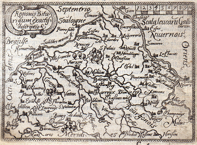
Miniature map covering area of Chalons, Avalon and Dijon. From “Theatro del Mondo” the famous plagiarised version of Ortelius’ pocket atlas published specifically for the Italian market by Pietro Marchetti. First printed in Brescia this is the really rare Venetian edition of 1667. [cod.1212/15]
- Author: MARCHETTI Pietro
- Year: 1667
- Dimension: 75 x 105 mm
- Place of publication: Venice
A map of French regions of Champagne and Brie, with decorative title cartouche.Shows administrative divisions, towns, villages, forests, mountains and rivers. From Atlante Novissimo, illustrato ed accresciuto sulle osservazioni, e scoperte fatte dai più celebri e più recenti cartografi by Antonio Zatta published in Venice in 1779. In very good condition with nice and decorative original colours.
- Author: ZATTA Antonio
- Year: 1779
- Dimension: 405 x 320 mm
- Place of publication: Venice
Color pictorial map of Lyonnais covered with vignettes drawings of people and products of the province with explanation, representing region’s historical figures and events, resources, sights, churches, important buildings, people, activities, crops, etc. Includes decorative title cartouche and compass rose. Relief shown pictorially. Published by Ode Paris in 1951 from a drawn by Jaques Liozu.
- Author: Jacques Liozu
- Dimension: 490 x 320 mm
- Place of publication: Paris
- Year: 1951


